


The little known planning reform that could help us build more homes
How the new national development management policies could be used to boost growth

Local plans, which local councils are supposed to use to guide development, currently have two types of policies. Strategic policies set out how much new development is needed and where it should be located, and “Development management policies” explain how individual planning applications will be decided. Development management policies cover topics like flood risk, noise impacts and energy efficiency.
As part of the government’s planning reform agenda, development management policies will be set at a national level. Although this is one of the least talked about reforms, national development management policies could be a powerful tool for increasing the supply of homes.
Here are some examples as to how that could work.
Allowing brownfield sites to be redeveloped more quickly
Everyone agrees that building more homes on previously developed land is a sensible thing to do. Almost all brownfield sites start out as something other than housing, so the planning system has to decide whether or not the change of use is acceptable even before considering issues like design.
National policy deals with this in quite a broad way. Local authorities are encouraged to support housing development on sites allocated for other uses when there is no reasonable chance of it being developed otherwise. Where sites aren’t allocated for a specific use, councils should support their redevelopment provided it “would not undermine key economic sectors or sites or the vitality and viability of town centres.”1
In practice, local authorities often interpret this in quite a restrictive way. Local policies frequently require premises to have been vacant for a long period of time, along with evidence of marketing and even financial appraisals showing redevelopment isn’t commercially viable. It can take several years to prove the case. Policy ER2 below from the Milton Keynes Plan is fairly typical.
That makes the system very unresponsive to changing patterns of demand.

This is exactly the sort of area where the NDMPs can make a big difference, making the system more proactive simply by being prescriptive as to how to show the appropriateness of redevelopment for a new use.
For example, rather than wait until a property has been long vacant, redevelopment could be allowed where premises have just become vacant or a lease is coming to an end. This could be combined with an agent report confirming that, in their professional opinion, the premises are unlikely to be attractive to the market. This would allow sites to be redeveloped more quickly and avoid them sitting empty for a prolonged time, while still protecting those sites which are genuinely needed.
This approach could similarly apply to all uses that fall within Class E – shops, offices, cafes, restaurants etc. If planning permission for the redevelopment of sites in those uses were quicker, easier and more predictable, developers will be less likely to use the Permitted Development route (which allows them to convert buildings without planning permission). That is likely to improve the quality of the built environment overall.
Making Settlement Boundaries Flexible
Settlement boundaries - lines drawn around towns and villages on local plan policy maps, delineating the current extent of the built-up area - are another way the planning system limits the amount of land that is available for development.
Development outside settlement boundaries is typically prevented simply because it is outside the settlement boundary. The site might be suitable for development in all other respects – well related to services and facilities, well served by public transport and with no real impact on the landscape – but applications are refused simply for being on the wrong side of that line. That stops settlements growing outwards and acts as a significant constraint on the supply of sites.
A small number of local planning authorities already have policies which treat these boundaries more flexibly - provided a list of criteria are satisfied. For example, Ribble Valley and Cornwall both have policies allowing new homes to be built outside settlement boundaries provided it represents “rounding off” and is of an appropriate size relative to the settlement.
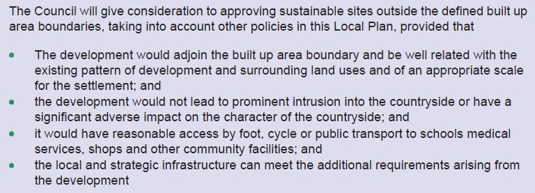
High Peak go even further. Their local plan says they will “give consideration to approving sustainable sites outside the defined built up area boundaries” provided they meet a list of criteria including how well it relates to the settlement, accessibility and its impact on the countryside.
The NDMPs could replicate this type of policy at a national level, setting specific criteria for when it is appropriate for new homes to be delivered outside of existing settlement boundaries (and avoid highly subjective phrases like High Peak’s “give consideration to”!). The “rounding off” approach – as in Cornwall and Ribble Valley – would be particularly useful in increasing the supply of small sites.
Defining “Infill”
Infill development refers to building new homes in the gap between existing buildings. There are quite a few references in national policy to infill development being acceptable - “limited infilling in villages” is one of the few types of development that is acceptable in the green belt, for example.2
But – perhaps surprisingly – “infill” isn’t actually defined anywhere. That creates uncertainty and planning risk for developers.
A prescriptive definition – say, a gap between properties not exceeding 50m in width – would increase certainty and see more development take place, while increasing the density of our existing settlements. As these would all be small sites, it would be particularly helpful for smaller developers and self-builders.
Rural Exception Sites and First Home Exception Sites
Rural Exception Sites3 and First Home Exception Sites4 are both intended to help increase the supply of affordable homes by allowing planning permission to be granted on sites which would not otherwise be considered suitable for new homes. To secure permission, however, national policy requires the developer to show that the affordable homes are actually needed. How to demonstrate that is interpreted in a variety of different ways by local authorities, and often in a highly restrictive way.
Defining the process would be a big help. How big an area needs to be considered? How is need demonstrated? If it needs a survey, how should that be structured? (It is not unheard of for Rural Exception Site applications to be refused because of the design of the questionnaire). Or can it be done from readily available data sources on housing prices and incomes? What does it mean to be “proportionate in scale” to the existing settlement? And what actually is “rural”?
Yet again, increased certainty reduces planning risk which will mean more applications are submitted and a greater proportion of them approved.
There will be many other ways where setting development management policies nationally will be able to help more homes be delivered. It just needs a bit of thought. And the best thing of all about the NDMPs is that it only has to be done once, rather than advocating for the same policies on more than 300 separate occasions through individual local plans.
This is set out in paragraphs 126 and 127 of the December 2023 version of the National Planning Policy Framework (NPPF).
NPPF, Paragraph 154.
NPPF, Paragraph 82
The policy for this is what my old boss would call “a bugger’s muddle” so I’m afraid there isn’t a neat reference.